31 December 2014

An attempt on Lingmoor Fell

A New Year's Eve walk with Emma and Nathan and Andrew and Helen.

Route: leaving the cars at Elterwater (both National Trust car park and the informal parking outside the village), crossing the river and taking the road towards the quarry turning right to follow a path by the river eventually climbing to the quarry view. Then taking a path rising up hill to dog leg left and the right onto the hillside rising into cloud and increasing rain. At the main switch back left, Emma and Nathan turning back leaving the others to reach the summit ridge in heavy rain and cloud and so turning left to drop down into Little Langdale for a pint in the Three Shires. Then heading south along the road to take the track past Wilson Place cottage and farm to return to Elterwater finding Emma and Nathan in Wainwright’s.

Conditions: low cloud and heavy rain.

Pub: the Three Shires, Little Langdale for Loweswater Gold during the walk. No pub after.

28 December 2014

Circuit above Brigsteer

A 7km+ run onto the Scar from Brigsteer.

Route: leaving the car in a large layby (space for 10+ cars) north of the village and running back, south past Brigsteer on the lower road but branching left on a footpath signed St John’s Church just beyond the village. Uphill across a couple of fields to turn right on a track and then branching diagnonally left off it across the large field to Helsington Church. North to the entry to the Scar and along the eastern path to climb eventually to the gate in the corner of two
walls before dropping past a large cairn (Dave’s Cairn) down off the Scar to Barrowfield Farm. Right then left to take a footpath descending through trees and across pastures eventually to strike a very quiet minor road. Left along this to reach the main Brigsteer-Underbarrow road and back to the start.

Conditions: a day of blue sky and sun but lingering heavy frost and cold air.

Pub: The Rifleman’s, Greenside, for Greene King Abbot Ale.

27 December 2014

Staveley 10km road run

A 10km road run to avoid sodden off-road paths.

Route: from the Mill Yard, Staveley along School Lane and Brow Lane to join the noisy A591 as far as Ings. Through the village as far as the Watermill and then turning left gradually gaining altitude on a gated country road. Turning left again at the end of the road and descending before another left turn and rising to the summit of the run with views of snow-covered fells. Then descending via the Crook Road back into Staveley.

Conditions: Initial warm sunshine, later cloud. (After the run, rain.)

Pub: The Hawkshead Brewery, Staveley, for Jingle Fells and Cumbrian Five Hop.

25 December 2014

Long Scar from Clapham

A Christmas day walk with Mark and, initially, Sandra and Max.

Route: from Croft House taking the bridleway above the valley to Clapdale, descending to the valley floor and past Ingleborough Cave. Through a hand gate and then climbing onto the hillside to reach the obvious cave on Long Scar. Then along the plateau to get a view over Crummack Dale and of Moughton Scars. Then back the same way but descending into Clapham Bottoms and back down Clapdale Drive past the lake and thence home.

Conditions: Initially sunny with blue skies. Later a cold wind, cloud and some drizzle.

Pub: Back home for Espresso Martinis before an excellent Christmas dinner chez Mark and Sandra.

30 November 2014

Variant circuit of Loughrigg

A 12km run on a suddenly beautiful autumnal day.

Route: from the lower Ambleside car park, taking the path through the graveyard, round the church and then left through Rothay Park to cross the River Rothay and turn right onto the Under Loughrigg road. Turning left, before the road re-crosses the river, onto a rising road then shady track to reach views of Rydal Water. Picking the upper, increasingly stony, path, eventually rising to reach the caves and then keeping to higher paths to reach the start of Loughrigg Terrace. Along this and then the higher track, at the end, through trees to reach the summit of Red Bank. Descending, left, to reach a track round the north of Loughrigg Tarn. Near the end of the track, but before reaching tarmac, taking a sharp left onto a stoney walled track rising and turning to circumnavigate the hillside rising to reach a spur and following a grassy path, right, to reach Lily Tarn. Descending on a grassy, muddy path to reach the main track over Loughrigg and thence back over the bridge over the Rothay and back to the start.

Conditions: a cool but cloudless sunny day.

Pub: the Hawkshead Brewery, Staveley for WPA and NZPA.

15 November 2014

Brock Crags

A short out and back with a circuit of Angle Tarn with Mike and Janet Hornby followed by 90 minutes looking for Janet who wasn’t actually lost.

Route: leaving the car in the Hartsop car park (still spaces at 10am but full shortly after) and following a footpath sign a little further back into the village to gain the hillside. Then climbing across tussocky grass and bracken to reach the start of a lengthy substantial diagonal path north east to climb onto a marshy plateau and reach the Coast to Coast path under Satura Crag. Following this towards Angle Tarn (where Janet turned back) and circuiting the tarn anti-clockwise, across very wet and marshy land to climb onto Cat Crags and then reach the cairn at Brock Crags. Continuing the circuit round to reach the outward path and turning back the same way.

Conditions: a still, cloudy autumnal day with a uniform cloud base of 2,500ft.

Pub: the Brotherswater Inn for Barngates Brathay Gold.

9 November 2014

Red Screes

A wet walk in low cloud and rain with Steve and Tom Woodcock but Tom's highest fell so far.

Route: leaving Steve’s car at the Kirkstone pass car park and heading uphill on the paved path to the summit. Then down the ridge as far as the Struggle for Steve and Tom to be picked up and returned to their car, Lois picking me up tantalisingly close to the Golden Rule some minutes later.

Conditions: low cloud and no views. Varying rain. Very wet under foot.

Pub: the Hawkshead Brewery, Staveley, for Hawkshead WPA and Cumbrian Five Hops.

8 November 2014

Arnside Knott

A circular route diverted by a high equinox tide with Steve, Kathryn, Tom and Alex Woodcock.

Route: leaving the car on the promenade at Arnside and setting off on the coastal paved path but, on discovering the path to be flooded, heading inland to Red Hills Road and continuing on New Barns Road to approach the coast at New Barns. There taking a path across fields on the left to rise through woodland and, eventually taking a path through a gate signed Arnside Knott. Here, turning steeply left and a little later recrossing the wall to reach a viewpoint with panorama. Then following paths to the summit and diverting right to the trig point before continuing down hill in the direction of the viaduct and, by minor roads, reaching the car.

Conditions: very high tide, some light rain, cloudy.

Pub: No 17, Milnthorpe, for Lancaster Red.

2 November 2014

A 12km variant circuit of Spy Crag and Millrigg Knott

A 12 km run on roads, tracks and muddy paths.

Route: leaving the Staveley Mill Yard via the foot bridge over the River Kent and taking the muddy path over south east field in the direction of the sewage works. Turning right along the road and then left 400 yards later on a steep drive before crossing a stream below a small waterfall at Side House and rising gently onto the edge of the fellside. Then turning left through Birk Field farm to join the minor road north and descending onto the upper reaches of Hall Lane. Gradually gaining altitude again on a stony track before taking a grassy path first rising and then descending, and becoming rough under foot, through the HP Plantation. Back along the road to Ullthwaite Bridge and then by track and then a quiet road to recross the river at Scroggs Bridge. Along a path to join the start of Hall lane and then back to the footbridge into the Mill Yard.

Conditions: a still, sunny Autumnal day.

Pub: the Hawkshead Brewery, Staveley for Hawkshead WPA and Cumbrian Five Hops.

19 October 2014

Silverdale circuit northwards


A short circular coastal walk with a beer festival thrown in.

Route: leaving the car at the bottom of the rear drive to the Woodlands Hotel and walking west along the road before branching right on a footpath through a caravan park. Then turning left to reach a woodland path near, but without views of, the sea. At the cove just north of Arnside Point, descending onto the sand and walking along this around the headland as far as New Barns. Turning inland and climbing over a spur off from Arnside Crag following signs for Arnside Tower and from it taking a path continuing above Elmslack to reach the drive past the Woodlands Hotel.

Conditions: despite a dire forecast, no rain and merely a cloudy but extremely windy autumnal day.

Pub: the Woodlands Hotel for Mordue Workie Ticket, Purple Moose Glaslyn Ale and Dancing Duck Dcuk.

15 September 2014

Rothbury to Berwick

The final, 50 mile day of the cycle trip, heading north, sometimes on Sustrans Route 68.

Route: heading initially west to Thropton before turning uphill north west and into the cloud to Trewitt Hall, then north east to join the main road descending to Whittingham. Climbing to Glanton and beyond and descending to Powburn where, the coffee shop being shut, coffee was taken at a garage. East to Branton and then either fording/wading the river (Steve) or crossing by bridge (the others) before tracking the edge of the National Park north. A detour to stay off the A696 followed by a spin through Wooler and then another detour to the north of the A-road before sprinting to reach a sadly closed pub at Milfiled. On via the 68 to lunch at the thatched Black Bull pub at Etal. Afterwards a relentless, hilly B6354 to Berwick.

Conditions: initial low cloud and drizzle giving way to heavy rain.

Pubs: at lunch time, the Black Bull, Etal for bottled Hadrian Border Brewery Farne Island; in the evening the Barrel Ale House for Jarrow Brewery, Rivet Catcher; Hadrian Border Brewery, Secret Kingdom and Arran Brewery Dug IPA.

14 September 2014

Newcastleton to Rothbury

A 58 mile, third day of the cycle trip cutting through the hills via Kielder Water.

Route: taking the B6357 to Saughtree. Then turning east on a minor road, shared with motorcycles, climbing very gradually to the border and coffee at Kielder Castle. Taking a wide undulating but sometimes busy road past the reservoir (the Moulton’s gears broke catastrophically here) and then country roads to The Cheviot, Bellingham for lunch. Taking initially steep country roads to reach Elsdon for tea at the Bird in Hand and then a long climb and fine descent into Cocketdale and a mix of climbs and descents along the southern side of the valley to reach Rothbury.

Conditions: a cloudy, greyer, bleaker day, even quite chilly at lunch time.

Pubs: at lunch time, The Cheviot, Bellingham for High House Farm, Nel’s Best and Allendale Tyneside Gold; in the evening, the Queens Head, Rothbury for Kelham Island Dark Moor, Jennings Cumberland and Brewdog IPA.

13 September 2014

Wheyrigg to Newcastleton

The second, 52 mile, day of the cycle trip with Ian and Steve.

Route: fairly directly by minor roads, thus cutting out the planned route via Bowness on Solway, for coffee outside a Costa in Carlisle. After a short detour in the wrong direction, out along the Reivers Cycle route as far as Hethersgill for lunch. Then, Lois suffering from a sore knee, taking a beeline roughly parallel with the river Lyne to Bailey Mill for tea and then by the Reivers detour route across empty moorland before dropping into Newcastleton.

Conditions: dry, mainly cloudy with sunny spells.

Pub: at lunchtime, the Black Lion, for Corby Ale; in the evening, The Grapes, Newcastleton, for bottled Ringwood Boondoggle.

12 September 2014

Whitehaven to Wheyrigg

A very flat, 51 mile official first day of the cycle trip with Ian Lyne and Steve Mitchell.

Route: taking a cycle path to Workington and then on another ex-railway on the Reivers Route Camerton and then by minor road to to Cockermouth for coffee in Brysons. Returning to Great Broughton and then climbing to cross Boughton Moor to Maryport for lunch outside the UKIP supporting Lifeboat pub. Taking an easy cycle way by a golf course to Allonby and then a tedious inland detour on the way to Silloth for a great coffee at Mrs Wilsons (kindly letting us in after the 4pm closing time). Then via rather squalid countryside to Wheyrigg Hall.

Conditions: warm and hazy but little direct sun.

Pubs: at lunchtime, the Lifeboat Maryport for Cumbrian Legendary Ales, Langdale; in the evening, the Wheyrigg Hall for bottled William Bros 7 Giraffes and the Birds and Bees, and Drygate Gladeye IPA.

11 September 2014

Kendal to Whitehaven

A 65 mile ‘zeroth’ day of the cycle trip with Ian Lyne.

Route: from home via Burneside to Staveley and then the main road to Windermere (and the first puncture), Ambleside (for a cycle shop) and Grasmere for coffee at the Potting Shed. Then via Dunmail Raise and the minor road to the west of Thirlmere (the party splitting by accident here) before passing through Keswick and the C2C detour to Braithwaite and lunch in the sun outside the Middle Ruddings. A steep climb over Whinlatter followed by a quick descent and then a mid afternoon pint outside the Kirkstyle Inn in hazy, even misty, weather. Then a further climb before a fine long speedy gradual slight descent from Rowrah on an ex-railway line cycle path meeting Steve Mitchell at the Georgian House B&B, Whitehaven.

Conditions: warm dry with hazy sun. No views of the fells.

Pubs: Middle Ruddings, Braithwaite for Cumbrian Legendary Ales, Langdale and Ennerdale Summer Ale; Kirkstyle Inn, Loweswater for Cumbrian Legendary Ales Pale Ale and The Vagabond, Whitehaven for Eden, Eden Gold and Fell, Tinderbox.

9 September 2014

Red Screes

A quick (55 mins) evening dash with Ian Rawe but without Lois.

Route: from the Kirkstone Pass carpark, out on the pitched path pausing part way to look for, and not immediately find, the alternative chimney route and so continuing to the top by the normal route. After a brief pause, back the same way.

Conditions: dry, hazy, a hint of sun. Warm for 7pm in September.

Pub: the Hawkshead Brewery being closed (after 6pm on a weekday), waiting until supper at Romney’s Kendal (joined by Lois) for Spitting Feathers, Northgate Ale.

31 August 2014

Gummers How

A short pre-lunch stroll with Gloria and Paul (Lois being at church).

Route: From the path at the rear of the carpark, through woodland to cross the road, on through more woodland and then climbing the steep paved steps to emerge from the trees to a view of the lake, the Hoad and Morecambe Bay. Then a very gentle scramble to reach the trig point. Returning by heading a little further north and then looping back round east to rejoin the outward path.

Conditions: sunny and cloudy with a hint of Autumn in the leaf colour.

Pub: joined by Lois and Mitch, the Masons Arms, Strawberry Bank for Ulverston Flying Elephant, lunch, and news from Gloria and Paul.

24 August 2014

Green Quarter Fell from Staveley

An arduous and rough 17+km run from Staveley up onto Green Quarter Fell and back. Great views from near Hollow Moor into the head of Kentmere but too much rough marshy pathless yomping to count as an entirely successful running circuit.

Route: from the Mill Yard through Staveley to reach Barley Bridge and up Hall Lane past Staveley Head Fell and gradually uphill on the bridleway as far as views of Skeggles Water. Picking our way over very wet marshy ground before leaving the right of way on what seemed like a track on the map but not on the ground and thus rising to a saddle just to the east of Hollow Moor with fine views. Descending steeply to find a path heading south east to Green Quarter. Thence along the road to Kentmere Hall and taking the lower level path - surprisingly dry - to the Kentmere industrial complex and then along the quiet road on the west of the valley before crossing the river to pick up the bridleway past Scroggs Farm to Hall Lane and then the back entrance to the Mill Yard.

Conditions: mainly warm with cloud and hot sun.

Pub: the Hawkshead Brewery, Staveley for WPA and NZPA with additional halves of IPA and 5 Hop on the arrival of Jemma and Alistair (and Lotte).

11 August 2014

Evening stroll to the Strickland Arms

A 10km there-and-back stroll to dinner with Ted Clark and his brother Jack.

Route: across the Strawberry Fields to Natland, across the green and taking the footpath after Appletree south east towards Cracalt Farm eventually crossing the path of the canal on rather a grand bridge and descending to the bank of river Kent. Along this to a footbridge and by Nannypie Lane to the pub. Back the same way in the deepening darkness but only having navigational difficulty in finding the canal bridge.

Conditions: after a windy and sometimes wet day, a pleasant evening and, on the way back, a still night.

Pub: the Strickland Arms, Sizergh for (dinner and) Youngs London Gold and Thwaites Hardy Tup.

9 August 2014

Wetherlam

A modest circuit from Coniston whilst staying, with Angie and Alistair, at Fir Bank.

Route: leaving the car on the road beyond the Ruskin Museum and walking further up to turn left on a footpath into the Coppermines area and then turning right uphill just after the hydro-electric scheme. Following the path that contours round the head of the Coppermines valley at a gentle altitude to the remains of the Thriddle water wheel and then up the Thriddle Incline to the Blake How ridge, and then along a grassy path to the top of Black Sails and across marshy ground to Wetherlam. Swirl How and Coniston Old Man being in cloud, turning right to the tarns at the top of Steel Edge but then descending directly to Hole Rake, the hydro-electric scheme and back to the car.

Conditions: low cloud but some sun. Very windy on top. Later, when sitting outside the pub, a warm sunny afternoon.

Pub: the Black Bull, Coniston for Coniston Infinity IPA and K7. Joined, by chance, by Angie and Alistair.

28 July 2014

Steeple, Scoat Fell and Pillar from Ennerdale

An almost deserted walk from Ennerdale.

Route: leaving the car at the Bowness Knott car park (free; 1hr 40mins from Kendal) and taking the obvious track along the valley, past the lake, to reach a concrete bridge over the river Liza and then bending left on the far side to cross another bridge over a stream. Heading uphill in a widening gap in the trees, the path weaving left to right but always steep. Once onto the fellside, bending left to cross the flank of the Lingmell, ford Low Beck and then ascend the narrowing ridge of Steeple. Then onto the main ridge of Scoat Fell and along to the rocky summit of Black Crag before climbing onto the Pillar plateau. Descending by heading north west down an initially very rocky and then faint grassy path on the White Pike ridge, fording a stream at the bottom to find a marshy track more steeply down hill, then a forestry track to the west and then another steep path down by the ravine of Low Beck and then back by forestry track to the bridges and a long trek back to the car park.

Conditions: early sun giving way to cloud but still strangely hot and humid.

Pub: Middle Ruddings, Braithwaite, for Fell Brewery AAA and Kirkby Lonsdale Singletrack.

27 July 2014

8km run north of Staveley

A surprisingly new circuit on paths, tracks and small roads.

Route: from the Mill Yard, crossing the river by the new footbridge and heading south east over fields to reach and turn right on the back road. Taking a track to a small waterfall and continuing on the right hand side of the stream up the valley before turning left and descending to Birk Field. Joining the (familiar) road and heading past Littlewood Farm to Ghyll Bank and taking a tiny path down a field of damp grass before dog legging left right across another road and following tracks to Elfhowe. Along the track through Scroggs Farm to Hall Lane and back to the start via the footbridge.

Conditions: hot and sunny.

Pub: the Hawkshead Brewery, Staveley, for WPA and 5 Hop.

23 July 2014

Pic de la Pena, Tour de Goa and Casteil

An airy circuit above Casteil.

Route: from the rented house in Cornellia-de-Conflent along the red marked hillside walking route through trees to Vernet-les-Bains (though a slight misstep at the start). Descending steeply to the church and then through town to cross the Cady and, at the entrance to the campsite, pick up a yellow marked path climbing steeply up to Pic de la Peña with vertiginous views back south. Following an initially narrow ridge along a number of subsidiary summits to reach the Tour de Goa. Then a left turn down a stony track to the Col de Jou and taking a small path through a gate to the left of the melée to pass through Casteil and eventually along a road to Vernet-les-Bains. After a beer, back along the same footpath above the main road home.

Conditions: very, very hot and sunny.

Pub: C’est Quand Le Bonheur, Vernet-les-Bains, for 25cl of Jupiler.

22 July 2014

A walk in Cerdagne from the Train Jaune

A nearly seven hour walk back along the route of the Train Jaune with James, while staying at Corneilla-de-Conflent.

Route: taking the 8:55 train from Villefranche out as far as that train runs to Font Romeu (after a lengthy delay at Mont-Louis waiting for the return train to clear the single track). Then walking 500m to look at the solar power station before turning uphill to the outskirts of Odeillo to find a grassy track over alpine meadows to Bolquere and a tiny weak lager outside a café. Then on over an emptier landscape to reach and circuit the fort at Mont-Louis before entering the walls for lunch. Taking a tiny and uninspiring path in the corner of a field to descend steeply down into the valley and join a more major path to the Refuge La Cassanya. Descending to the valley bottom, shortly after, with views of the Train Jaune suspension bridge (Pont Gisclard) to cross a small river and join the Sentier Botanique back under the bridge and along the side of the valley before dropping down at St-Thomas-les-Bains to regain the train line at Fontpédrouse. Here, although a train was due at 6:25pm, we called for a lift back from Jo.

Conditions: initially cool but sunny all day.

Pub: a bar in Mont-Louis for lunch with rough Catalan red wine (and dry cider for the lady) and then canned Estrella Damm from the corner shop in Fontpédrouse.

21 July 2014

Circuit from Corneilla-de-Conflent

A circuit from a rented cottage in Corneilla-de-Conflent to Villefranche-de-Conflent.

Route: from the centre of Corneilla-de-Conflent, leaving the village by the narrow road to the right of the statue to cross the main road and taking a small road on the far side down and across two rivers to reach the far side of the valley. Now taking a marked path climbing steeply through oak trees to reach a dolmen on the top of a low ridge. Here following a track not quite on the summit of the ridge gaining altitude. At a bifurcation, turning sharp back left to gain further height to the Citerne Vauban (old water cistern). Descending on a tightly zig-zagging path to Villefranche and a beer. Then taking a path on the far side of the main road which slowly climbs crossing a narrow swiftly flowing canal and then zig-zags to a summit fort for lunch. Descending and tracking west on a wide plateau to visit first the Cabane d’en Bullas (a pre-Roman stone bergerie) and then a view back over Villefranche. Retracing the route to reach a (pink) marble quarry and then following signs back down the hill to cross a shady stream and regain the centre of the village.

Conditions: hot and sunny. Some breeze at altitude.

Pub: Le Vauban, Villefranche for Leffe Blonde.

1 July 2014

Evening cycle ride to Staveley

A 25km evening cycle ride to the Eagle and Child, Staveley.

Route: from home along the canal path to Dockray Hall Road to join the Burneside Road and meet Lois emerging from a Burneside Parish Council meeting. At Bowston taking a right turn across the river to join the back road to Staveley and round to the pub. After a pint or two, back along the direct route (but not the bypass) via Plantation Bridge.

Conditions: Warm light evening cycling out. Just about dark on the return but still not cold.

Pub: Eagle and Child, Staveley, for Kirkby Lonsdale, Singletrack and Allendale, Wolf.

28 June 2014

Cunswick and Scout Scar

Not really an ‘outdoor day’ but a reminder of how good a running course Scout Scar is (Lois being on a train back from the Big Smoke).

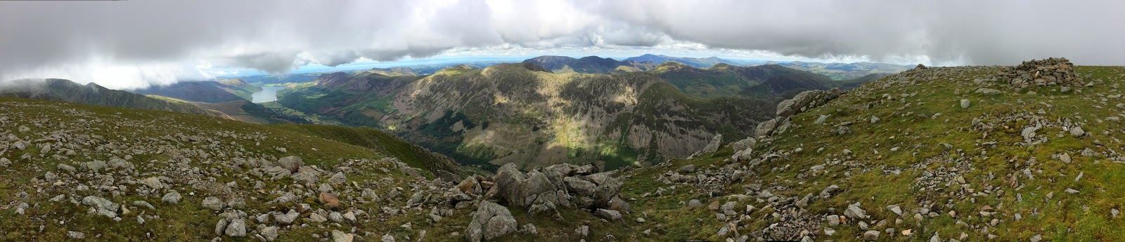
Route: from Greenside, Kendal, taking Serpentine Road to the tramway and along this to climb and cross the golf course before heading, past Highland cattle, over the bypass and on up to the cairn on Cunswick Scar. Then back, descending in the direction of the Scout Scar transmitter onto the broad saddle past gorse, hawthorn and rabbits before a lengthy but gradual climb, staying between 50m and 50 feet of the wall. Turning right as the wall turns right and slightly uphill for another 100m before bending left to cross the field towards a gate into a wood. Taking the first right and then bending gently left to reach the disused quarry, now a car park, and crossing the road to climb on a gravel path onto Scout Scar. Keeping along the edge and thus passing ‘the mushroom’, a lateral wall leading to the trig point and a large low cairn (‘Dave's cairn’), which marks the descent off the Scar into the Lyth Valley, before reaching the grassy combe that marks the end of the cliff. Here taking a hand gate to head forwards gently downhill and then up to join a broad grassy path with views of Arnside Knott and Morecambe Bay. Towards the end, bending left at a subtle fork to cut the corner of the south end of the Scar and to return towards a short steep escarpment. Keeping in the same direction beyond it until 1km later forced left, with a wall now to the right, and climbing back on to the top of the Scar and a gate in a corner. Here turning almost 180 degrees to descend on the other side of the wall for 150m where, after the path goes under a couple of trees, taking a faint path left and contouring along this until, just before another wall, it rises to meet the main path (back from Dave’s cairn). Along this to cross the race course and then turning left for a sore-footed 1.5km descent on a road back to Greenside, Kendal.

Conditions: cloudy but pleasantly warm.

Pub: the Rifleman’s for, unusually, Lancaster Bomber (because of a WW1-themed fete).

22 June 2014

Dalbeattie Civic half marathon

A last minute whim on discovering that the road to our rented cottage at Netheryett, Haugh of Urr, would be closed for a running event.

Route: from Dalbeattie high school, south to the A711 and then west for a mile before heading north on a quiet C road. After three miles, turning west to climb uphill before a descent into Haugh of Urr and then east along the Military Road before turning south, descending past Halket Leathes, climbing and then descending to East Logan to cross the river and run for a couple of miles south back to the start.

Conditons: hot in direct sun; some early cloud.

Pub: the Laurie Arms, Haugh of Urr for Broughton Willacade and Ayr Brewing Company, Leezie Lundie.

21 June 2014

Cycle ride to Kirkcudbright

A 63km cycle circuit from Netheryett Cottage, Haugh of Urr.

Route: heading south on the B794 and then west and south round the coast on the A711 before diverting south for coffee at Balcary Bay. Then back to the main road to continue uphill past a viewpoint (of Skiddaw) and down via Dundrennan Abbey to Kirkcudbright for lunch. Heading north to the hydroelectric power station at Tongland before crossing the river to head north east on a minor road to Castle Douglas and the Sulwath Brewery. Then back on the military road.

Conditions: warm cloudy sun.

Pub: The Selkirk Arms, Kirkcudbright, for Sulwath The Grace. The Sulwath Bewery, Castle Douglas,  for Galloway Gold.

20 June 2014

Rhinns of Kells

A 22km, 5+ hour, walk in the Southern Uplands during which we saw no one, not a sausage.

Route: from the car park at Forrest Lodge, taking Prof Hans Heiberg Road - a rough forestry track - through a conifer forest and then across a felled landscape slowly to gain altitude before leaving the road on a boggy track to cross a stile onto fellside. Then following a very minor track up over hillocks onto a discernible ridge and keeping in touch with a wall to the top of Meikle Millyea. Detouring to a further summit cairn 1km to the west for a view, there and back, and then following the ridge north on boggy ground to the bumpy knolls of Milldown and Millfire and up a long but dry grassy path to Corserine. A 1km detour north down to a saddle and then up to Carlin's Cairn for lunch and back and then east to try to find the descent. In retrospect, obviously overshooting and so roughing it over tussocky grass down the edge of a combe to cross a stile back into the forest and taking Robert Watson Road - we think - back to the car park.

Conditions: a hot and generally still day but with a gentle breeze on the tops.

Pub: The Bridge of Ken Hotel, New Galloway, for Orkney Crosscrake.

15 June 2014

Troutbeck tootle

An 8km run on a damp hot and humid day with very low cloud.

Route: Leaving the car on the first left turn before the church in Troutbeck and running through the Limefitt caravan park, past its Haybarn Inn and thus onto the bridleway towards the head of the valley on the eastern side which is flat or even downhill for 2km before rising gently. This time, at the Tongue, taking the first footbridge to cross the stream to pick up the track on the other side of the valley but diverging from it on a grassy footpath across a field to join the quiet road back along the valley bottom. At the point where the road turns right to Old Town, taking a narrow walled path (Truss Lane) straight on eventually rising to meet the main road. Crossing over and heading another 200m up a narrow road to take a left turn on a path descending to the church and hence back to the start.

Conditions: hot, damp and humid but no actual rain.

Pub: The Hawkshead Brewery, Staveley for WPA and NZPA.

12 June 2014

Great Carrs, Swirl How and Wetherlam horseshoe

A circuit of Mij's most viewed, also painted and possibly favourite fell the day after her funeral.

Route: leaving the car where the road broadens by Greenbank just before Wilson Place Cottage in Little Langdale and walking along the road to the Three Shires Pub for a half pint stiffener. Then down towards Jam Street but diverging half right to Slaters Bridge and along the bridleway above Greenburn Beck but crossing it on a footbridge to climb onto Wet Side Edge. Ascending into cloud and walking, viewless, along the ridge to reach Great Carrs. After a short descent, ascending to the summit of Swirl How. Descending Prison Band to emerge into sun for the first time and then slowly climbing onto Wetherlam. Descending Wetherlam Edge onto Birk Fell Man and dropping down to the right, pathless before climbing another pair of small summits. Then descending to cross a wall and then a bilberry rich marsh to climb Low Fell and Knott Head before a tricky pathless descent through bracken and marsh to reach the outward bridleway and a return to the Three Shires.

Conditions: initially low cloud but later clear skies and warm sun.

Pub: the Three Shires, Little Langdale for initial halves of Coniston Old Man and Loweswater Gold and then later for Loweswater Gold.

8 June 2014

Copy of the Grasmere Gallop

Pretty much the Grasmere Gallop but on the day after the official event.

Route: leaving the car in the northerly pay and display car park (£5 for 4 hours) in Grasmere but starting the run from the loos in the town centre. Then past the Jumble Room and Tweedies, turning right on Red Bank Road and gradually gaining altitude. Just before a double chevron, taking the upper of two paths on the left to the top of Loughrigg Terrace and down this, past the caves, to reach the northernmost point of Under Loughrigg Road. Along the road almost as far as the footbridge to Rothay Park but turning right (walking) up the steep paved road which becomes a loose track over the shoulder of Loughrigg and down to Loughrigg Tarn. Rising gently beside this on the track to its east to rejoin the road climbing to the top of Red Bank for a second descent of Loughrigg Terrace. Then along the lake shore until forced back onto the road and back to the car park.

Conditions: warm sun, some cloud, occasional cool breeze and a very brief refreshing shower towards the end.

Pub: Tweedies Bar for Cumbrian Legendary Ales American Invasion and Marble Brewery Pint.

26 May 2014

Reston Scar and Hugill Fell

A short walk on a numb sort of day after the night my mother Mij died.

Route: Leaving the car in the mill yard carpark and heading north on Back Lane past the war memorial to the left turn on a broad switch-backing path up Reston Scar keeping to the left on a narrow ridge at the edge of the plateau to approach the summit. Then down on a clear grassy path, through a gate and then trending left through newly planted trees to another gate before turning sharp right to rise eventually to the Hugill summit. Taking a gate in the field corner beyond to turn right to walk round and then to cross a significant bog to the summit of Black Crag and then steeply down to the Kentmere road and back.

Conditions: Surprisingly warm, cloudy sun.

Pub: The Hawkshead Brewery, Staveley for WPA, and keg Cumbrian Five Hop.

11 May 2014

Bowland Bridge circuit

A 13km run with Ian Lyne before lunch with Mitch and Steve.

Route: Leaving the car in the car park of the Mason’s Arms, Strawberry Bank (booked in for lunch 90 minutes later) and descending past Bowland Bridge taking the quiet country road on the east side of the river northwards past Barkbooth, dog-legging left and right after 3 miles. Crossing the A5074 at the Brown Cow at Winster and continuing up hill before dropping back to the west to join the A5074 briefly heading east for 200m and then taking a bridleway on the right. Following a rough path to join a track and climb the west side of the valley and then along empty tracks, then quiet roads to Hartbarrow and a descent back to the Mason’s Arms.

Conditions: despite the forecast rain, an almost dry if cloudy run.

Pub: the Mason’s Arms, Strawberry Bank, for lunch and Corby Blond and Stringers’ Wolf Warrior.

10 May 2014

50km cycle pub crawl to Windermere and back

A 50km cycle pub crawl partly resulting from not fitting 3 bikes onto a cross-Windermere passenger ferry (the road ferry being closed for five year maintenance).

Route: from home up the hill past the Station Inn and then along Paddy Lane to descend to cross the A685 and, after a steeper descent, slowly to cross the River Mint south of Mealbank. Turning left to Skelsmergh, crossing the A6 and continuing by back roads to Staveley for a pint at the Hawkshead Brewery. Then past Staveley station and climbing along the route of the Dales Way to reach the Crook Road and a swift descent first to the (car) ferry terminal and then, having just missed the replacement ferry at Bowness (and hence the planned shore-line route to Ambleside), the Royal Oak for a pint. On failing to fit onto the next ferry 40mins later, giving up and cycling up to Windermere Station and along the main road to the Watermill at Ings for lunch. Then along the cycle route through Staveley and Burneside back home.

Conditions: low cloud and repeated rain showers, sometimes heavy.

Pubs: Hawkshead Brewery, Staveley, for Hawkshead WPA, Iti NZPA, Gold; The Royal Oak, Bowness, for Coniston Bluebird and Taylor’s Landlord; the Watermill, Ings, for lunch and Watermill Golden Retriever, Dogth Vader and Bit o’ Ruff and Cumbrian Legendary Ales Loweswater Gold.

5 May 2014

Cartmel Fell circuit

An 11+ km circuit on Cartmel Fell, mainly on paths.

Route: leaving the car in the car park by Cartmel Fell Village Hall and running around the church to the right and northwards to the nearby farm before which turning left and following a footpath rising and bending right below Pool Garth after which turning right at an ornamental pond featuring a frog band sculpture (see photo). Down a track and right onto a field and then left at the bottom of the second field to find a level path heading north through damp grass eventually to cross the footbridge over the River Winster to join the road to Bowland Bridge. At the village junction turning left across the bridge and then right onto a footpath through woods and across a field. After a stile, keeping below the woods on through Hollins Farm farmyard and along an enclosed track along the valley floor, often muddy in places, to meet the road near Great Hartbarrow farm. Going left along the road up a steep hill, right at the junction and on until the road swings right after Oaks farm. Taking, instead, the footpath straight on, initially by the wall and then crossing to the other side of the valley and rising to bypass a house and taking a waymarked route across fields to the woodland in Moor How Park. Descending through woodlands to turn left at a footpath T-junction and rising uphill again to the top of the ridge. Then descending on a muddy and stoney path crossing streams and along a boardwalk to meet a path on the left which emerges from the wood, rises over a small shoulder and goes down the meadow, Whinney Knott, with good views over the Winster valley to Whitbarrow, to reach a gate at the bottom right of the field. After 100 yards down the road past Lightwood taking a track on the right for about a mile to join the road after a twisty descent (marred by a motocross event in full flow). Turning right and after 300 yards left onto a footpath just before the road signed Cartmel Fell Church down through the woods to the start.

Conditions: cloudy and some hazy sun but poor visibility.

Pub: the Castle, Kendal, for Loweswater Gold (meeting Paul, Amanda, the kids and friends (Seve, Dave and Steve) after a Kendal urban orienteering event).

4 May 2014

Cycle circuit to Staveley

A 40km cycle ride to the Hawkshead Brewery and back.

Route: from home, steeply uphill to the Station Inn and then continuing to rise to the midpoint of Paddy Lane. Then a glorious descent to cross the A685 and a careful, steep descent to a bridge over the River Mint south of Meal Bank. Turning right to rise north east, on a wide road, onto high moorland from which, presumably, there would usually be good views. A steep descent to Patton Bridge and then a detour to look at Whinfell Tarn (hardly worth it). Back at Patton Bridge taking a pretty quiet road, west, rising within a narrow valley to reach a crossroads (left here) eventually descending steeply to cross the A6, wiggling through Garth Row and then a brief but horribly steep ascent to a right turn and then a left onto the Potter Fell Road. Along this to descend to the main back road to Staveley with bluebells in abundance. After beer and lunch (and replacing brake blocks) returning on the back road but sticking to the valley bottom to re-enter Kendal via the Mintsfeet industrial estate and then back along the canal path.

Conditions: very low cloud, occasional drizzly rain.

Pub: the Hawkshead Beer Hall, Staveley, for WPA and Red.

3 May 2014

Clapham circuit

An 11km run north and east from Clapham, on the way back from visiting Mij and Grahame.

Route: from the car park in Clapham (£2.50 for 2 hours), taking the road north and then a track east of the church through two very dark and stony tunnels and then up onto the shoulder of the hillside of Norber. Straight on and down to a crossroads with a minor road, taking a left turn heading uphill, the road becoming a track. On this to a grassy bridleway which turns left and goes uphill again near Crummack. At this point mistakenly bearing too far left and thus ending up too far to the south to reach the cairn on Long Scar so striking across rough country to reach the gate in a wall and downhill on a stony walled track (Long Lane) eventually rising to meet the outward path and return through the tunnels.

Conditions: cloudy but stuffy and humid.

Pub: The Bunkhouse Café Bar, Clapham, for Taylor’s Landlord (joined by Mark and Sandra)

26 April 2014

Variant circuit of Loughrigg

A 12km run, before meeting Angie and Alistair for supper in Ambleside, replacing some of the road running of the previous route with higher paths on the fell.

Route: from the lower Ambleside car park, taking the path through the graveyard, round the church and then left through Rothay Park to cross the River Rothay and turn right onto the Under Loughrigg road. Turning left, before the road re-crosses the river, onto a rising road then shady track to reach views of Rydal Water. Picking the upper, increasingly stony, path, eventually rising to reach the caves and then keeping to higher paths to reach the start of Loughrigg Terrace. Along this and then the higher track, at the end, through trees to reach the summit of Red Bank. Descending, left, to reach a track round the north of Loughrigg Tarn. Near the end of the track but before reaching tarmac, taking a sharp left onto a stoney walled track rising and turning to circumnavigate the hillside rising to reach a spur and following a grassy path, right, to reach Lily Tarn. Descending on a grassy, muddy path to reach the main track over Loughrigg and thence back over the bridge over the Rothay and back to the start.

Conditions: sunny and cloudy but none of the predicted rain.

Pub: the Wateredge Inn, Ambleside for Barngates Cracker. Later, the Lily for supper and Loweswater Gold.

19 April 2014

Red Screes from Kirkstone Pass

A walk and run (just under 10km) on a glorious Easter Saturday.

Route: starting from the carpark opposite the Kirkstone Pass Inn and heading straight up the re-engineered path to the top of Red Screes at a brisk walk. Then running down the grassy and occasionally marshy ridge towards Ambleside as far as the Struggle. Taking the left turn, a little further down the the road, on an initially level track which then drops to cross the stream on a bridge and back up the far side of the valley onto the track linking farm cottages. Up this walking and running by turn to near the top of the Struggle and then walking steeply back to the start.

Conditions: warm and sunny. Very heavy queuing traffic from Ings at least as far as Troutbeck Bridge forced a change of plan to start the route at the Kirkstone Pass rather than Ambleside.

Pub: the Hawkshead Brewery, Staveley for WPA and El Dorado.

18 April 2014

Cycle ride to Arnside

An evening cycle ride to Arnside.

Route: from home down Oxenholme Road to Natland Mill Beck Lane and thence to gently uphill to Natland, along through Sedgwick, Hincaster to Ackenthwaite. Then along Paradise Lane to Beetham and the steep climb and speedy descent to reach Black Dyke Road eventually to arrive downhill into Arnside to reach the Fighting Cocks. After a pint, along the front to visit Jo and Roger for coffee (new machine!) and then back on the same route out (for L to Asda), though T feebly taking the direct route home via Oxenholme.

Conditions: bright sun and blue sky but cool by 7pm.

Pub: Fighting Cocks, Arnside, for Thwaites Coiled Spring.

Circuit above Brigsteer

A 7km+ run onto the Scar from Brigsteer.

Route: leaving the car in a large layby (space for 10+ cars) north of the village and running back, south past Brigsteer on the lower road but branching left on a footpath signed St John’s Church just beyond the village. Uphill across a couple of fields to turn right on a track and then branching diagnonally left off it across the large field to Helsington Church. North to the entry to the Scar and along the eastern path to climb eventually to the gate in the corner of two walls before dropping past a large cairn (Dave’s Cairn) down off the Scar to Barrowfield Farm. Right then left to take a footpath descending through trees and across pastures eventually to strike a very quiet minor road. Left along this to reach the main Brigsteer-Underbarrow road and back to the start.

Conditions: a gorgeous sunny Good Friday.

Pub: the Hare and Hounds, Levens, for Lancaster Brewery Lemon Grass and Unsworth Yard The Land of Cartmel.

14 April 2014

Evening cycle ride to Bowland Bridge

A 30km cycle ride to the Hare and Hounds, Bowland Bridge to have supper with Jane, Andrew and the boys.

Route: from home into town, then up Gillinggate and relentlessly on up and over the top of Scout Scar along the Underbarrow Road. Steeply downhill on the twisting road to Underbarrow, then rising up and along through Crossthwaite, crossing the A5074 and coasting gently downhill to Bowland Bridge. After supper, returning in the dark, struggling a bit with the relentless climb to the top of Scout Scar and arriving home at 11pm.

Conditions: warm sun with a cool breeze on the way out; pitch black, clear skies with nearly full moon and chilly on the way back.

Pub: the Hare and Hounds, Bowland Bridge for supper and Stringers Yellow Lorry.

13 April 2014

13km circuit of Spy Crag and Millrigg Knott

A 13km run in Kentmere.

Route: leaving the Staveley Mill Yard by the footbridge over the river and turning south east on a path across fields to turn left onto the back road. Taking the first path to the right of this and climbing through woods to reach Spring Hag and left on a bridleway to reach the elevated plateau. Then by road and then track past Ghyll Bank to approach High House but turning diagonally left, downhill before it, somewhat pathless and very rough on the ground but with fabulous views. Gradually gaining altitude again on a stoney track before taking a grassy path first rising and then descending, and becoming rough under foot, through the HP Plantation. Back along the road to Ullthwaite Braideg and then by track and then a quiet road to recross the river at Scroggs Bridge. Along a path to join the start of Hall lane and then back to the footbridge into the millyard.

Conditions: cloudy and cool.

Pub: the Hawkshead Brewery, Staveley, for WPA and NZPA.

12 April 2014

Short run to the Stratford-upon-Avon obelisk

A short pre-theatre run to the obelisk in Welcombe Hills country park while staying at 1 Percy Street.

Route: from 1 Percy Street along Clopton Road to its end and then on a faint path slightly uphill across mown grass to the corner of the field. Then north along a muddy bridleway (crossing ridges and furrows) for 200m before turning right and descending slightly to the obelisk. Then back south past the Welcombe Hotel, through the Dingles, to reach Welcombe Road. At the end, right on St Gregory's Road, left on Maidenhead Road to reach the canal and back along the tow path to Clopton Road and back.

Conditions: a warm sunny evening with a cool breeze.

Pub: the One Elm, Stratford-upon-Avon for Purity Ubu.